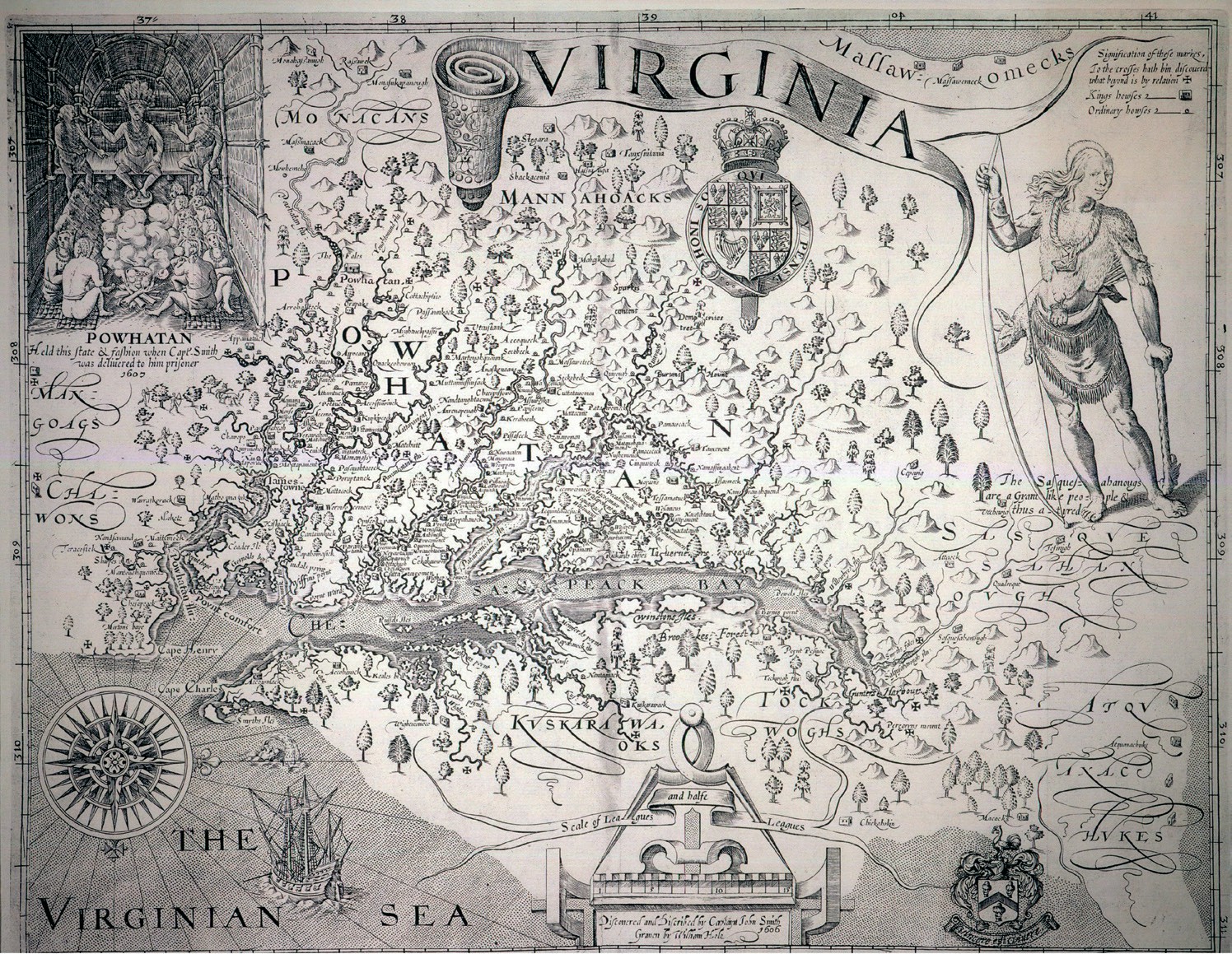
What is the purpose of a map? As a functional tool, of course, it helps someone get from A to B. Yet it can also be educational if it depicts a part of the world the reader might be unfamiliar with. Subconsciously, it can also help to shape the reader’s perceptions about the place.
John Smith (c.1580–1631) was an English soldier, adventurer, explorer and, later, writer. He spent time in Africa and Virginia, and explored the coast of New England. His map of Virginia was first published in 1612, just 5 years after the first permanent English settlement in North America. It was widely circulated in England over the following decades. Smith had spent time in Virginia in 1608–9, and this is a very accurate depiction of the rivers, coastline and islands of Chesapeake Bay in Virginia.
Your organisation does not have access to this article.
Sign up today to give your students the edge they need to achieve their best grades with subject expertise
Subscribe