
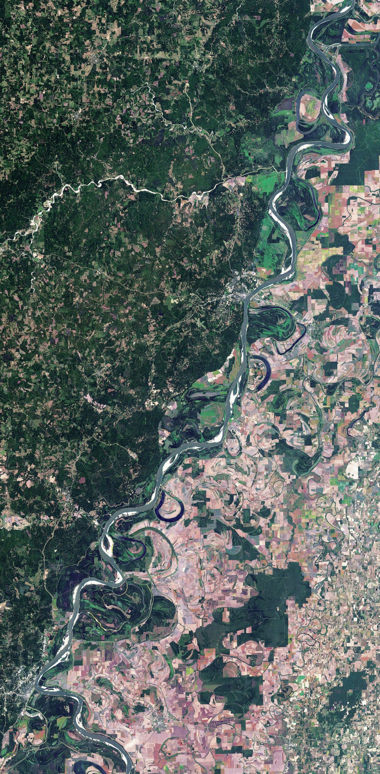
This satellite image illustrates the tortuous current course of the river and previous events. Earlier courses of the river can be seen, as can oxbow lakes — former bends that have been bypassed. After floods spread across the wide, shallow valley the river will often shift to a new channel
The 250 tributaries of the Mississippi– Missouri river system drain water from about one-eighth of the USA, and the Mississippi itself flows for about 3,800 km southward.
Over this enormous distance the Mississippi descends just 450 m, with a very slight gradient over its final section. This means the river flows very slowly and any sediment load it is carrying due to rainfall is soon deposited on the riverbed. Over time this raises the bed, making it likely that the river will overflow its banks, causing floods.
Your organisation does not have access to this article.
Sign up today to give your students the edge they need to achieve their best grades with subject expertise
Subscribe


