
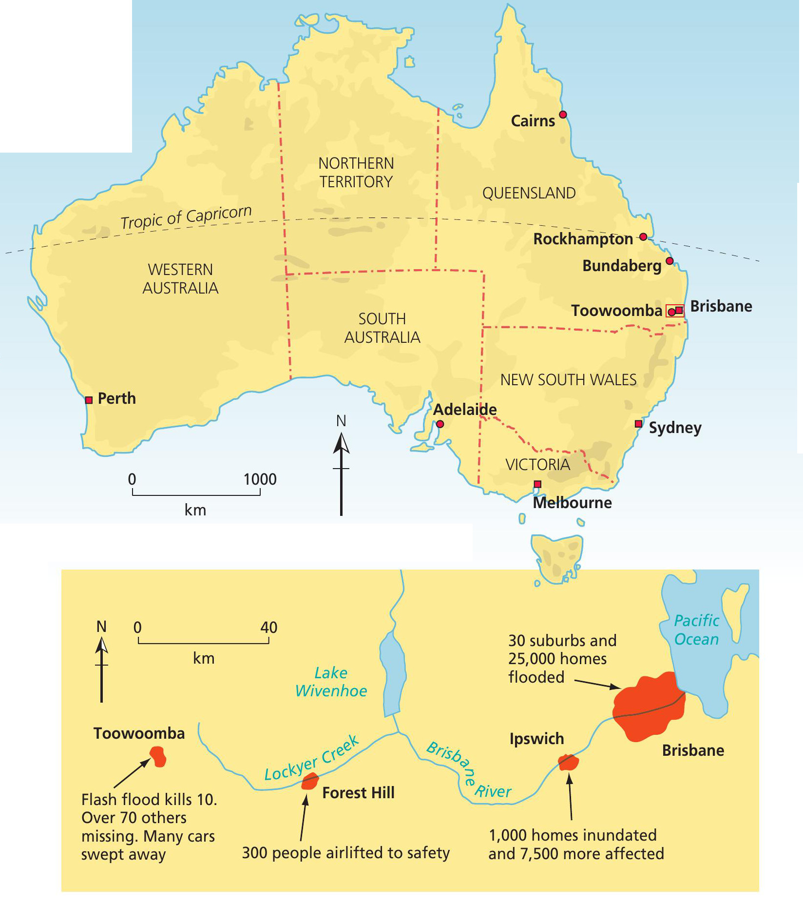
In December 2010 heavy rains battered the Australian state of Queensland, making it Queensland’s wettest December on record. The torrential rains continued over Christmas, peaking in January 2011 and leading to widespread flooding which affected at least 70 towns, including Brisbane, Rockhampton, Bundaberg and Toowoomba (Figure 1). Threequarters of the state of Queensland was declared a disaster zone.
Queensland is accustomed to heavy rain and flooding but not since 1974 have things been as bad as in early 2011. The initial problems were centred on the town of Rockhampton, then the rains moved south to threaten the state capital, Brisbane. This is Australia’s third largest city, with a population of 2 million. The danger was mainly posed by ‘slow floods’, resulting from the steady rise in river levels over a period of time. This meant there was time for flood warnings to be broadcast, for sandbags to be distributed, and for residents to move out to refuges as the threat level became more serious.
Your organisation does not have access to this article.
Sign up today to give your students the edge they need to achieve their best grades with subject expertise
Subscribe


