
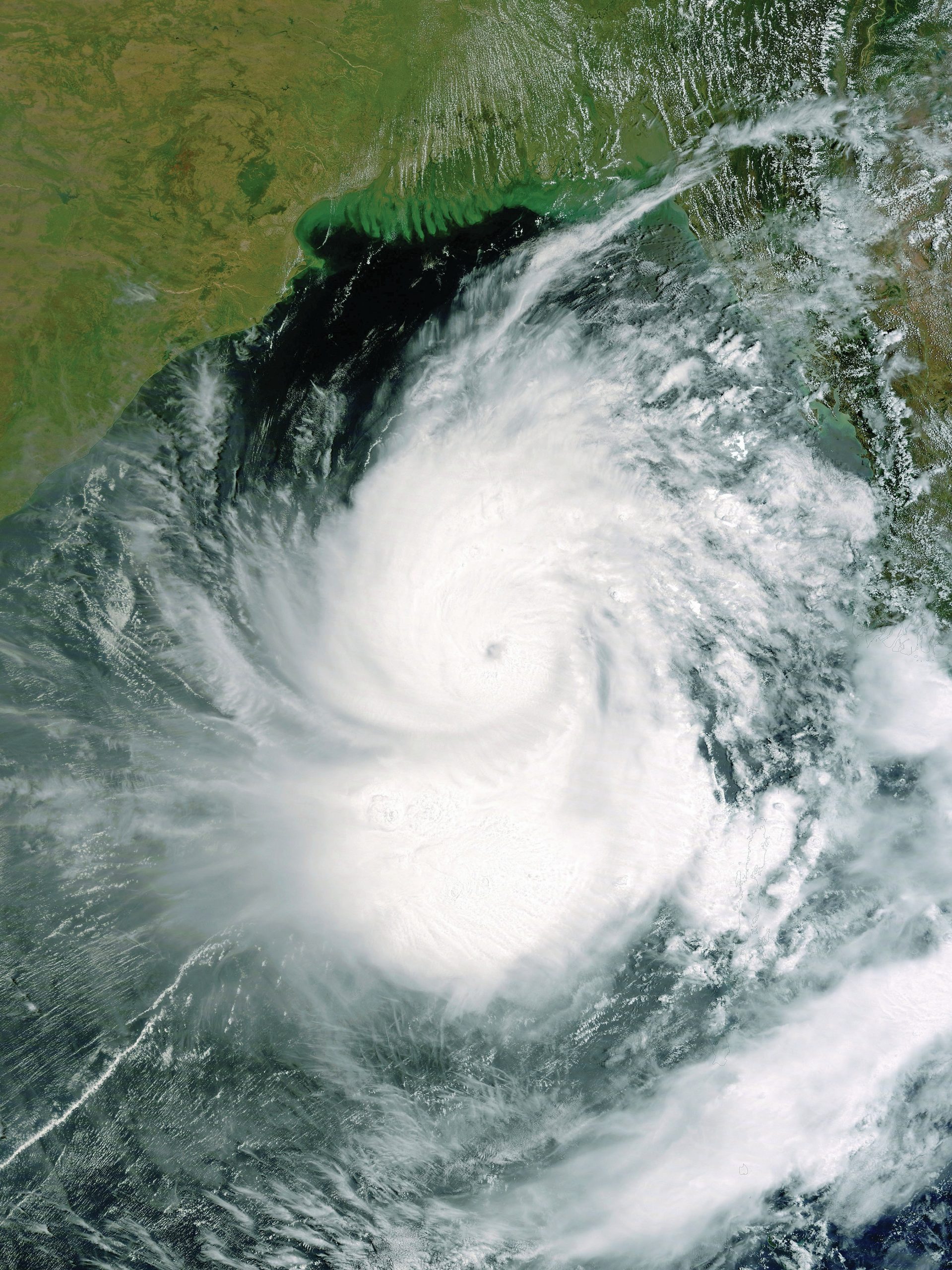
The Bay of Bengal is one of the world’s hotspots for the formation of the tropical revolving storms known as hurricanes or cyclones. These vicious storms, with their rotating winds reaching 200 km/h, begin over the warm seas of the Bay of Bengal between May and November and sweep northwards towards the low-lying country of Bangladesh (see map on the back page). Cyclones also affect the east coast of India and the coastal areas of Myanmar (Burma) on the western shores of the Bay of Bengal. Figure 1 shows the features of a tropical storm.
The country of Bangladesh is particularly vulnerable to cyclones as much of it is formed from the deltas of the rivers Ganges and Brahmaputra, so a lot of land is only a few metres above sea level. The strong winds of a cyclone can devastate villages, but it is the accompanying storm surge (flood of sea water), which funnels northwards up the Bay of Bengal, that is the most destructive force.
Your organisation does not have access to this article.
Sign up today to give your students the edge they need to achieve their best grades with subject expertise
Subscribe


