
Geography for me, as a teacher, is not just about learning about the world in the classroom but also being in it, travelling to different places, meeting people and sharing life with them, trying to understand a little more about the complex world that we live in. The information in this article was collected as I cycled through the Cascade mountains in the northwest of the USA as part of my journey of over 2,500 km from Vancouver to San Francisco.
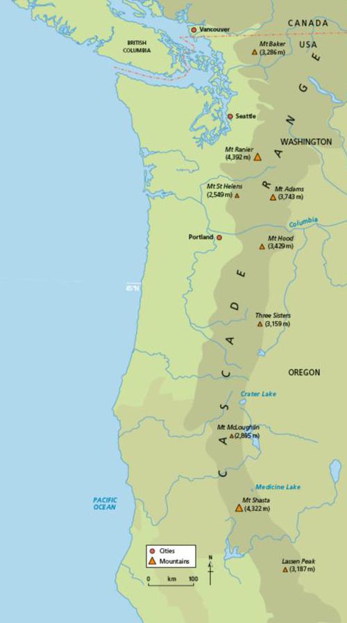
The Cascade mountain range lies in the states of Washington and Oregon in western USA (see Figure 1). The highest mountain is Mt Rainier (4,392 m) but Mt St Helens is perhaps better known. The Cascades are part of the ring of volcanoes and associated mountains that lie around the Pacific Ocean and are known as the Ring of Fire. All of the eruptions in the last 200 years in the USA, excluding those in Alaska and Hawaii, have been from Cascade volcanoes. Volcanoes occur here because the area lies at a plate boundary where the Juan de Fuca plate is subducting under the North American plate. This is called a destructive plate margin (see Figure 2). Earthquakes also occur in this area due to the plate movements.
Your organisation does not have access to this article.
Sign up today to give your students the edge they need to achieve their best grades with subject expertise
Subscribe


