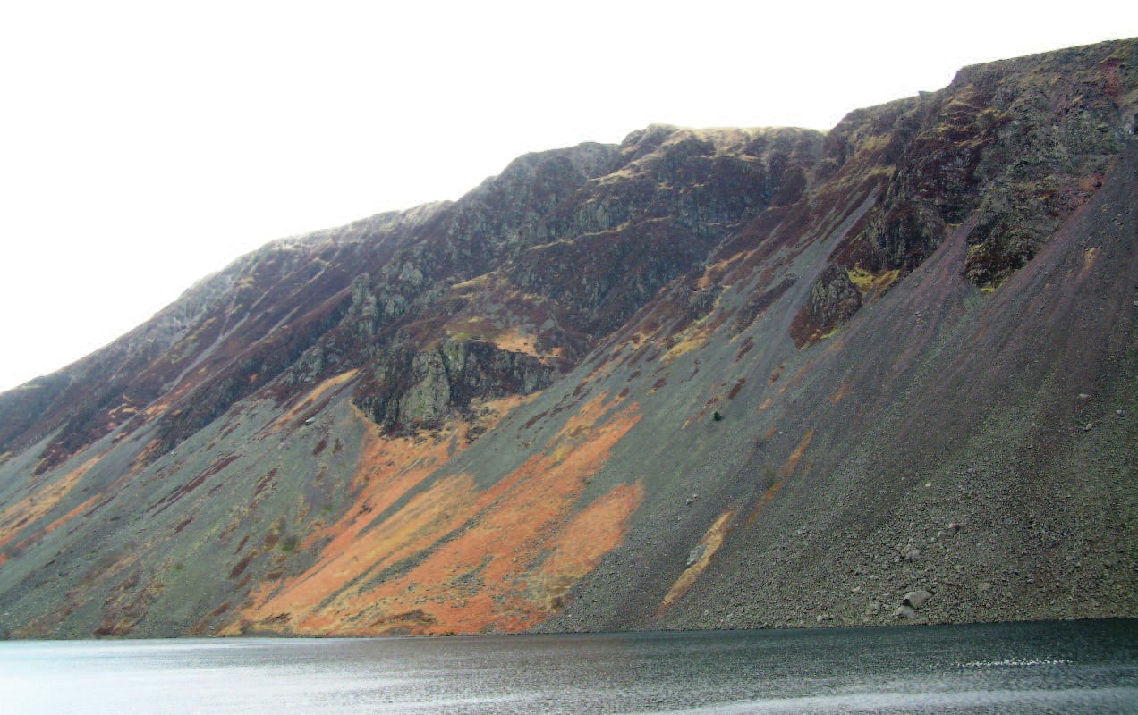
These two photos show slopes in the Lake District. Photograph A shows Wastwater screes in the west; the other slope, Photograph B, is in Mungrisdale in the northeast. Look closely at the two slopes. What differences can you see? What similarities? Among the variables you could compare are the shapes of the slopes, differences in vegetation cover, and evidence of erosion processes operating.
At the height of the last ice age, the Lake District was covered in ice, so we can speculate that the slopes buried beneath the ice had been largely stripped of any stone cover by the ice moving past. We can therefore ask whether the slopes we now see are simply what was left after the ice had melted or whether they have evolved in some way since that time. Obviously, the vegetation cover came later, but what about the shape of the slopes: has this changed at all in the intervening 10–20,000 years?
Your organisation does not have access to this article.
Sign up today to give your students the edge they need to achieve their best grades with subject expertise
Subscribe


