Land-use maps provide information about how the land is used in an area, including natural or semi-natural land cover, as well as the different types of built environment. Any permanent or semipermanent feature that takes up space on the ground, from a post box to a large factory, may qualify for inclusion on a land-use map.
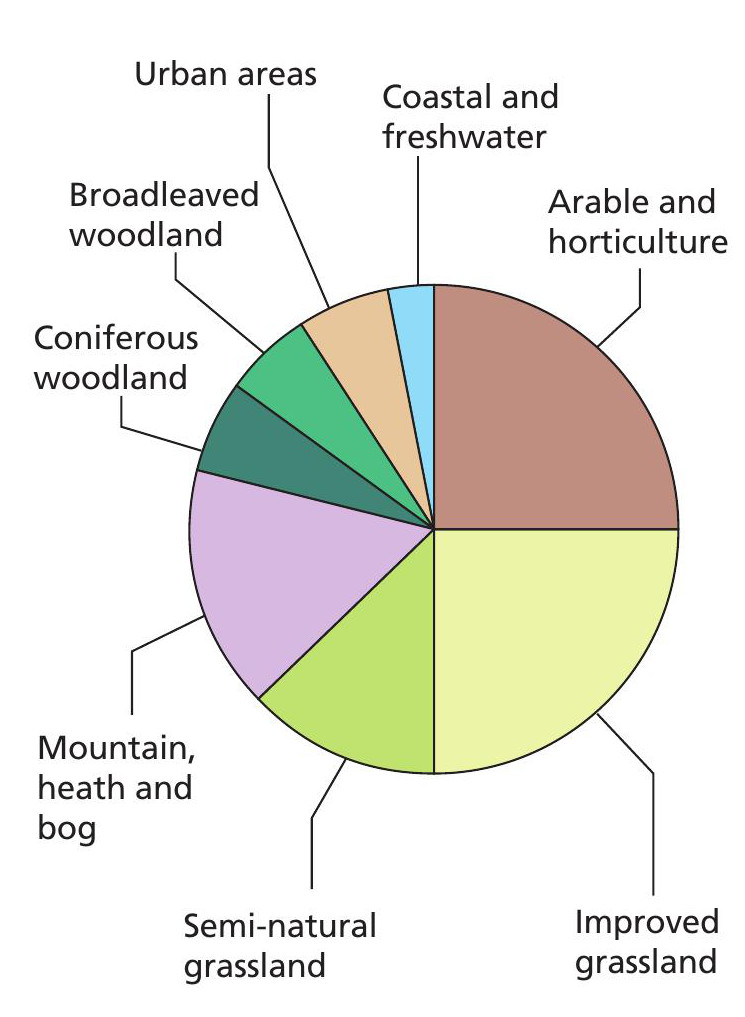
The first land-utilisation mapping of Britain was carried out in the 1930s by Sir Dudley Stamp, a professor of geography at the London School of Economics. More recent maps include the 2011 Land Cover Map project (www.tinyurl.com/5sbjvh2) which includes three-dimensional terrain models. Figure 1 shows the proportions of different land-use types in the UK, and Inset 1 shows the wide variety of applications of land-use maps.
Your organisation does not have access to this article.
Sign up today to give your students the edge they need to achieve their best grades with subject expertise
Subscribe


