Storm damage along the Dorset coast is not new. Hurricane-force winds famously battered the coast in 1824 and more recently, in the autumn and winter of 1978–79, there were two serious storm events. These caused considerable damage and led to a major coast protection scheme that was completed in 1988 (see Further research).
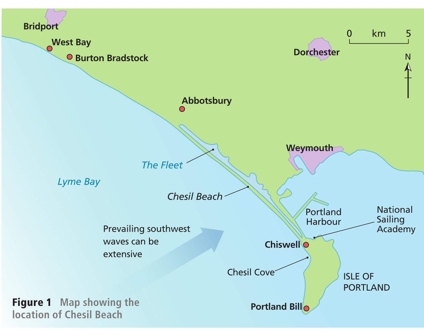
Chesil Beach is a barrier beach and tombolo (a beach which links an island to the mainland, Figure 1). The beach rises to around 14 m above sea level at the Portland end and gradually reduces in height northwestwards towards West Bay. It is made of shingle which varies in size from pea grit (0.5–1 cm diameter) at West Bay to cobbles (>6 cm diameter) at Portland. The beach is a fossil feature and there is no new source of shingle feeding it. This means that any permanent loss of shingle is a significant problem, particularly since the beach is a critical part of coastal protection in south Dorset.
Your organisation does not have access to this article.
Sign up today to give your students the edge they need to achieve their best grades with subject expertise
Subscribe


