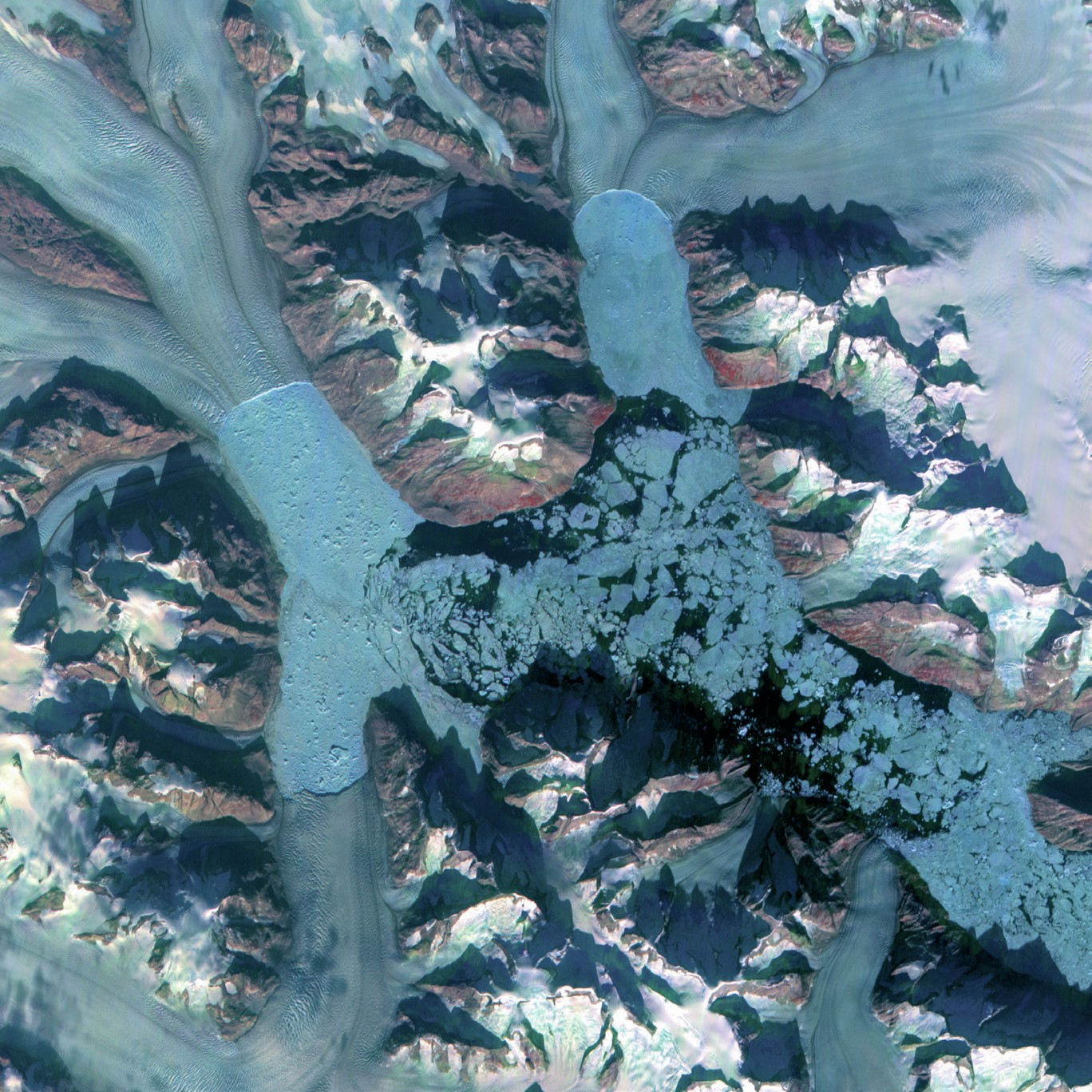
This satellite image shows a series of large tidewater glaciers in southeast Greenland that terminate at the coast in a deep fjord between steep rocky hills. Glaciers that reach the coast can lose mass by calving into deep water. Large blocks of ice topple into the sea to form icebergs.
Being able to interpret satellite and aerial images is just as important a geographical skill as map reading. Images like this are commonly used in university interviews, so it is worth honing this skill.
Your organisation does not have access to this article.
Sign up today to give your students the edge they need to achieve their best grades with subject expertise
Subscribe


