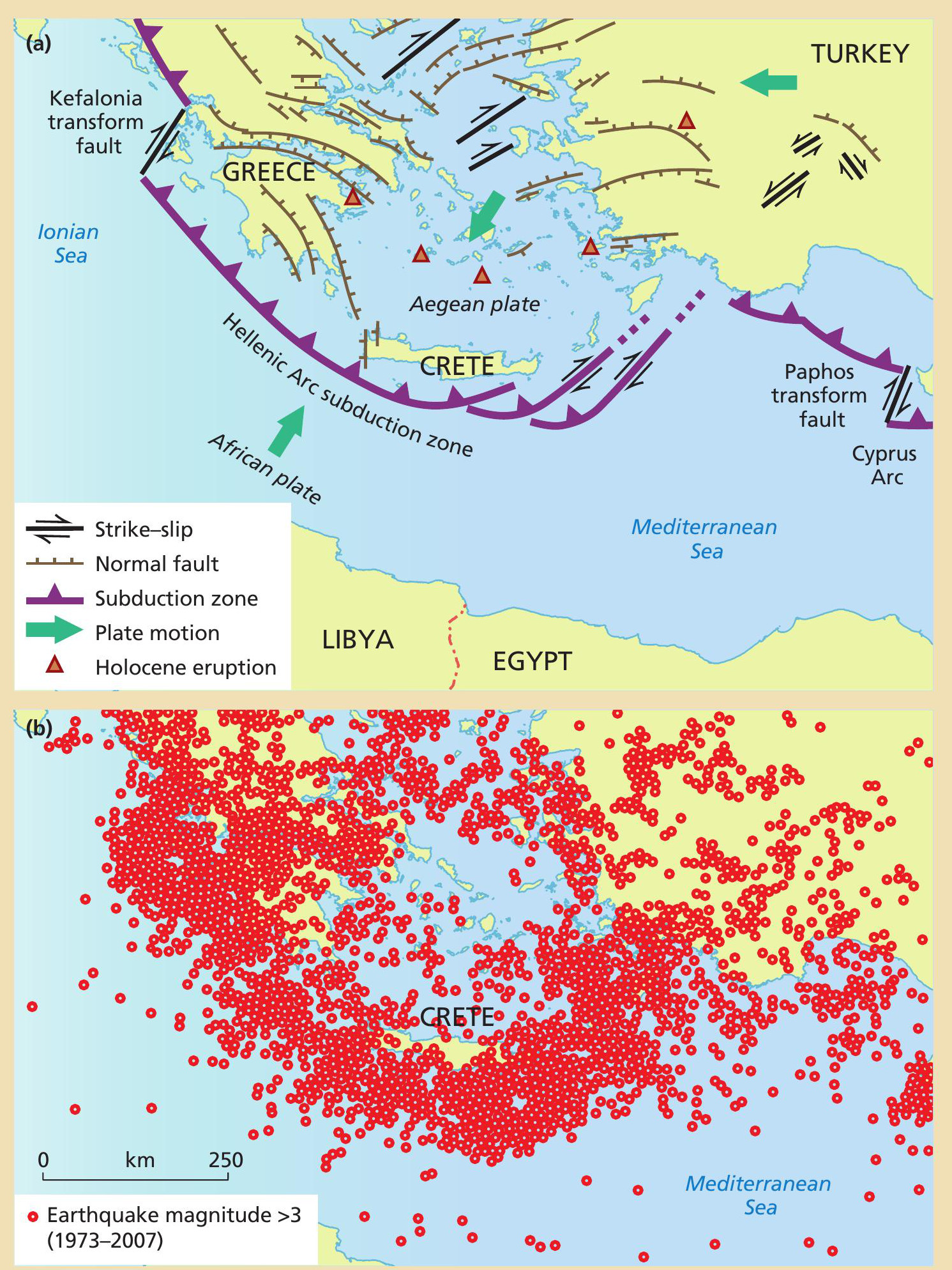
Crete lies in a subduction zone — the Hellenic Arc — where the African plate sinks below the Aegean microplate and the larger Eurasian plate behind it (Figure 1a). Plate motions create enormous stresses, so the crust in this area is riddled with active faults. Earthquakes, volcanic eruptions and tsunamis are part of the deep history of this region. Figure 1b shows the observed pattern of earthquakes (magnitude >3) between 1973 and 2007. Note the dense belt of seismic activity along the subduction zone close to the island of Crete.
In AD 365 Crete was hit by a devastating earthquake (magnitude >8.5) that caused widespread destruction. It was probably triggered by the rupture of a major thrust fault to the southwest of the island. The earthquake was so powerful that the southwestern corner of the island was uplifted more than 9 m, and >100 km of the coastline was raised between 4 and 8 m. Figure 2 shows the uplift contours at 1 mintervals.
Your organisation does not have access to this article.
Sign up today to give your students the edge they need to achieve their best grades with subject expertise
Subscribe


