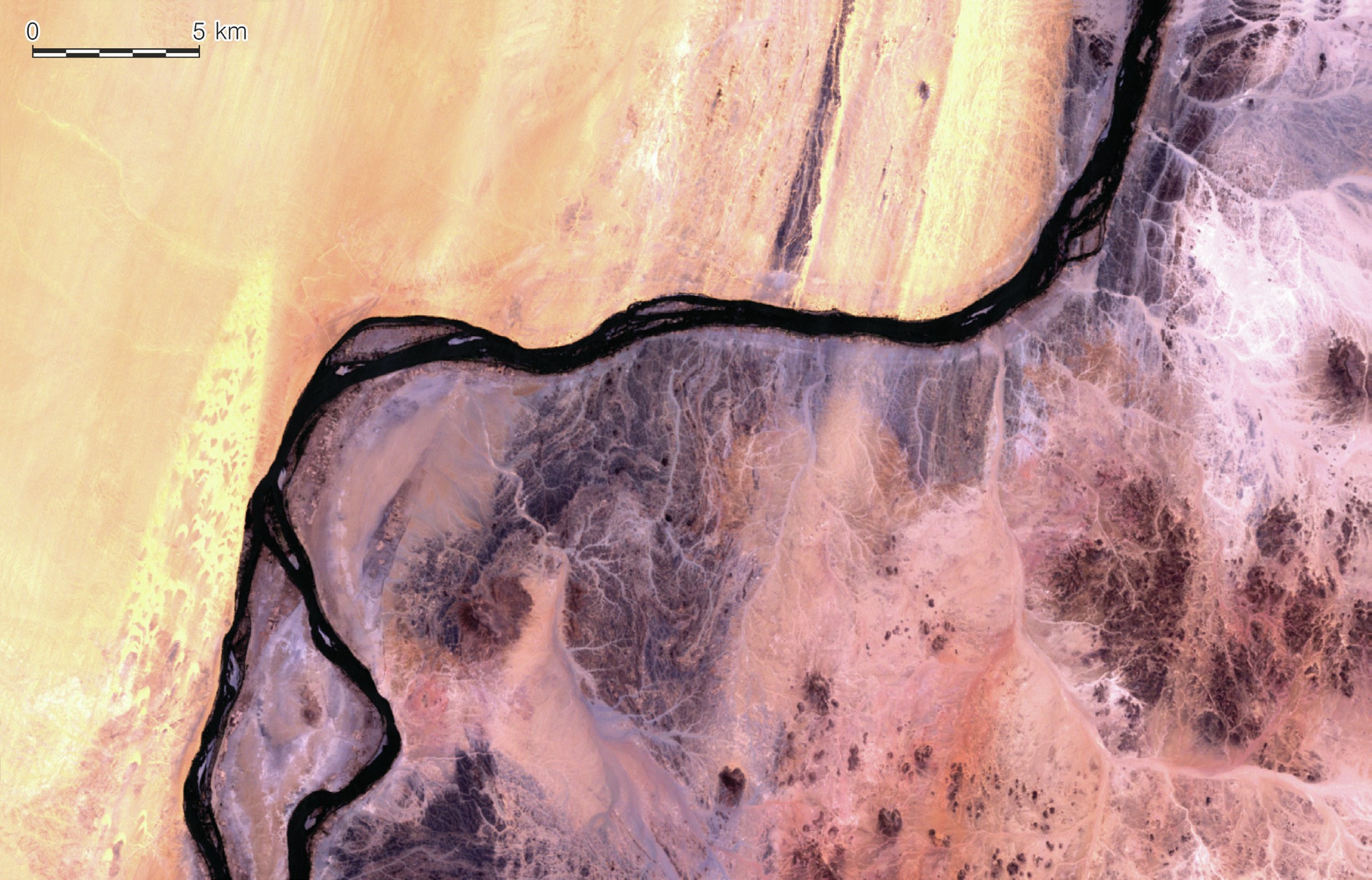
This true-colour satellite image of the Nile Valley in northern Sudan covers an area of about 40 × 30 km. It highlights striking contrasts between the desert landscapes on opposite sides of the river. The landscape to the north and west is dominated by yellow windblown sand from the north. Linear features are well developed and there is a long belt of barchan dunes in the far west of the image. The river provides an effective barrier to the movement of windblown sand so that prominent sand dunes have built up along the left bank.
The landscapes to the east of the river are very different. Here the land surface is dominated by bedrock and by ephemeral river networks. These dryland channels or wadis only flow with water during rare extreme rainfall events.
Your organisation does not have access to this article.
Sign up today to give your students the edge they need to achieve their best grades with subject expertise
Subscribe


