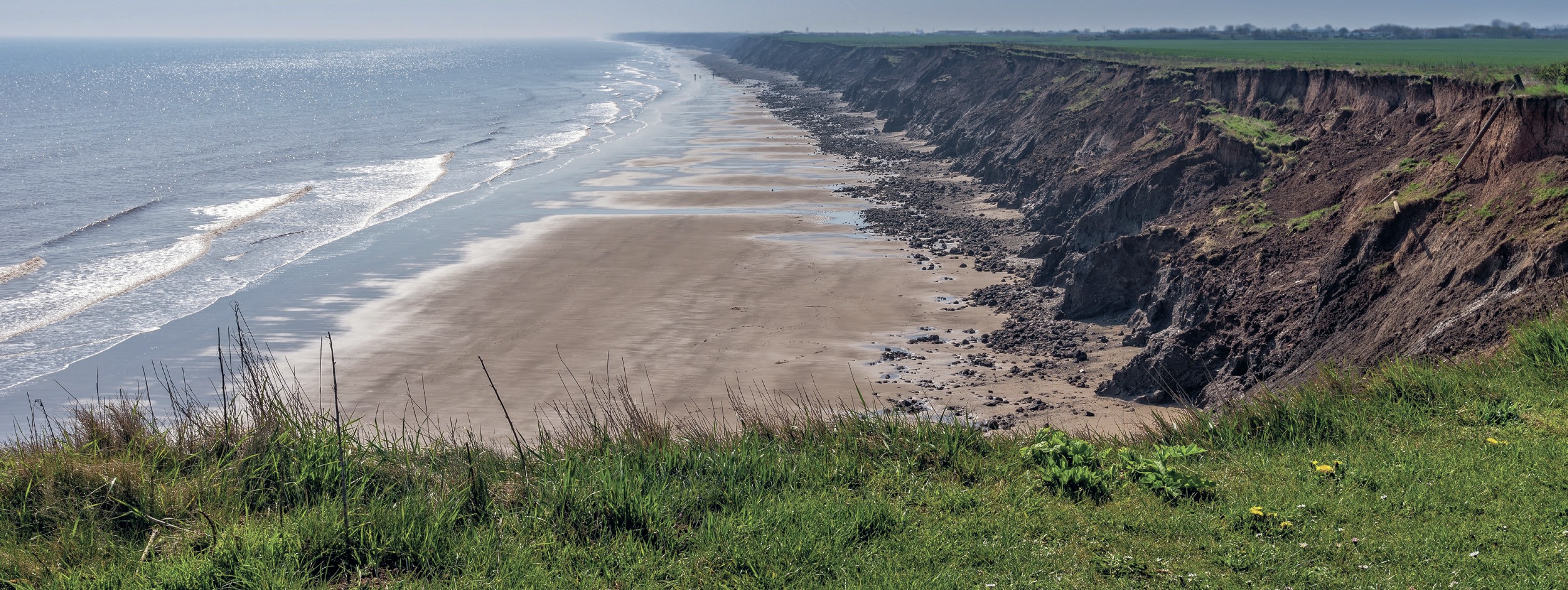
One of the revolutions in the study of landscapes over the past 20 years has been the easy availability of aerial imagery. Repeat aerial survey of landscape features is a great way to work out rates of change in sediment systems. You could for example use repeat imagery to work out rates of bank erosion in river systems or rates of glacier advance or retreat.
In the article on pages 2–6 Catherine Pennington and colleagues discuss rates of coastal erosion due to landsliding on the east coast at Holderness. This is a topic you could explore for an NEA, using aerial imagery. The most accessible source of aerial images is Google Earth, which allows you to use the history slider to compare images over time. Google Earth Pro, which is free to download, also allows you to take measurements from these images.
Your organisation does not have access to this article.
Sign up today to give your students the edge they need to achieve their best grades with subject expertise
Subscribe


