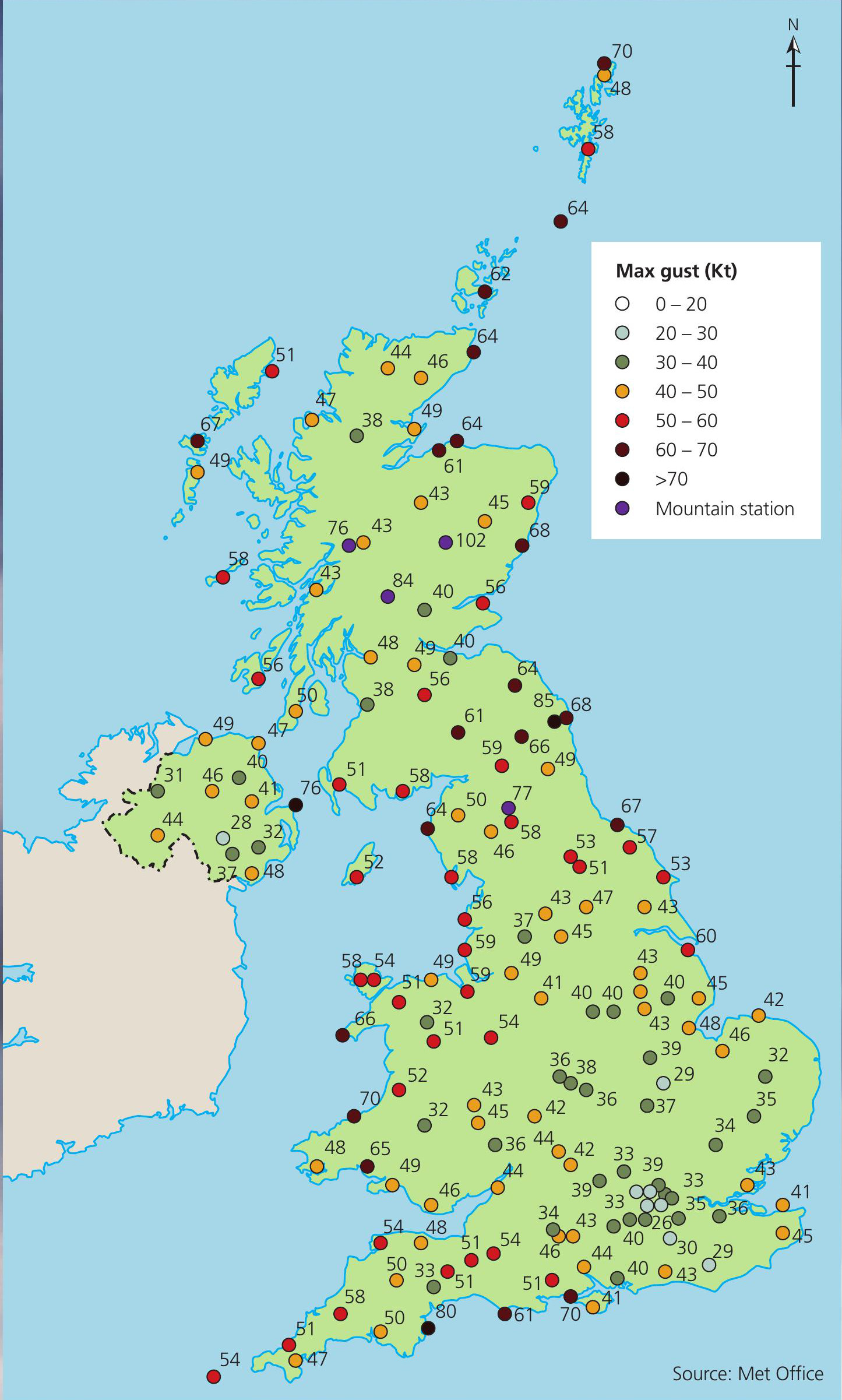
The frequency of tropical cyclone activity in the Atlantic, Caribbean and the Gulf of Mexico has been increasing sharply over the last decade. While in the UK we do not see the degree of hurricane threat found on the other side of the Atlantic, in a warming world we expect to see an increase in the frequency of high-energy meteorological events. This centrepiece is a case study of one such recent event: Storm Arwen.
On 26 November 2021, the Meteorological Office issued a rare red warning for northeast England and eastern Scotland. Storm Arwen was an intense low-pressure system which moved across the UK with the centre of the storm passing across Scotland and northern England on the evening of 26 November. By early on 27 November the centre of the low pressure had moved into the North Sea drawing strong northerly winds across Scotland and northeast England and depositing snow across much of the region. An animation of the storm can be viewed here: www.tinyurl.com/4rruz6zp.
Your organisation does not have access to this article.
Sign up today to give your students the edge they need to achieve their best grades with subject expertise
Subscribe


