Slapton Ley in Devon’s South Hams district is the largest body of fresh water in the southwest of the UK. Its National Nature Reserve covers an area of 214 hectares and is one of the most significant geomorphological and ecological features in the UK.
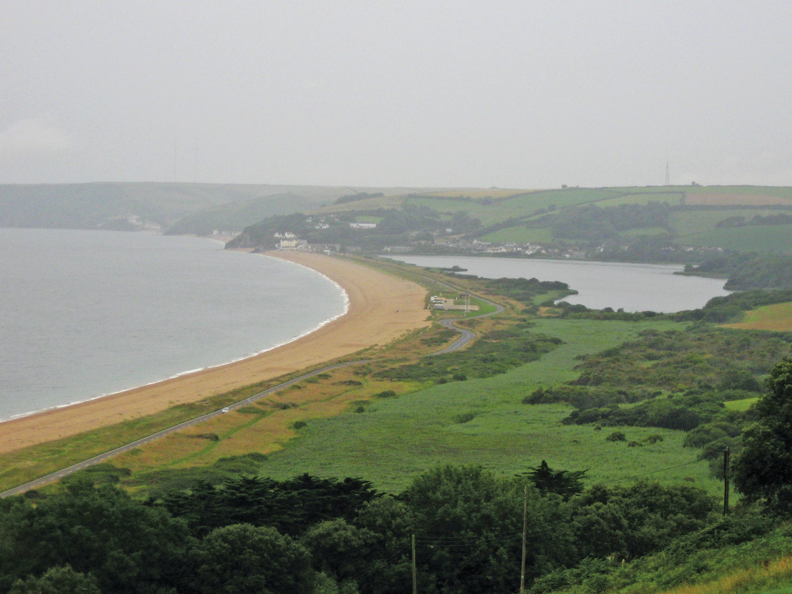
As shown in Figure 1, Slapton Ley is a freshwater lagoon created by a shingle ridge which separates it from the sea. This is a barrier beach formed and maintained through a combination of sea-level rise since the most recent glacial period and ongoing longshore drift. Despite being composed of shingle, pebbles and cobbles, the beach is referred to as Slapton Sands and extends from Torcross in the south to Strete Gate at the northern end of the bay. The lagoon is fed by local streams and rivers.
Your organisation does not have access to this article.
Sign up today to give your students the edge they need to achieve their best grades with subject expertise
Subscribe


