Your organisation does not have access to this article.
Sign up today to give your students the edge they need to achieve their best grades with subject expertise
Subscribe
geographical skills
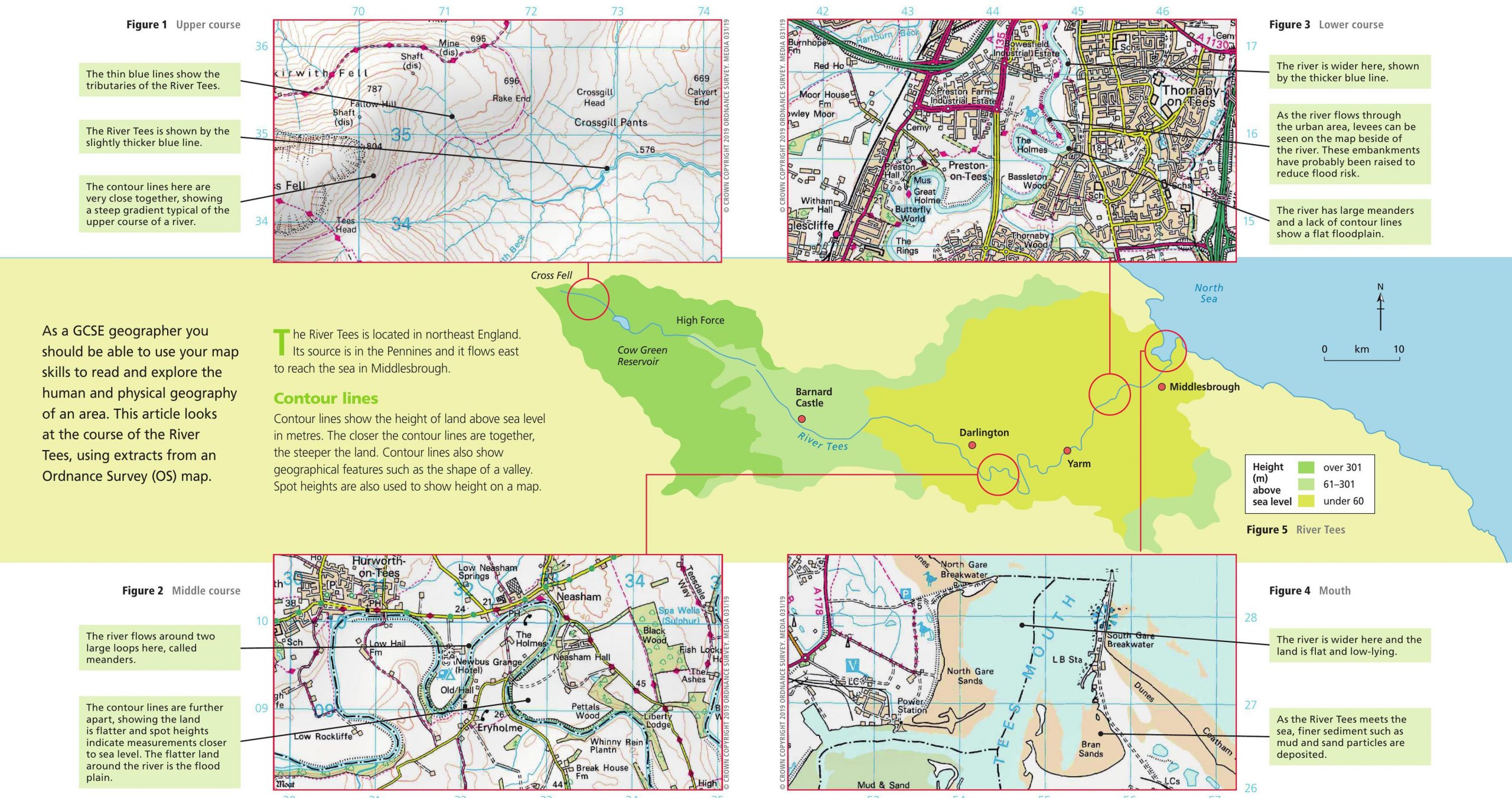
As a GCSE geographer you should be able to use your map skills to read and explore the human and physical geography of an area. This article looks at the course of the River Tees, using extracts from an Ordnance Survey (OS) map.
Sign up today to give your students the edge they need to achieve their best grades with subject expertise
Subscribe
English Review

English Review

English Review

English Review